« Return to Lakes
 Chequamegon Waters Flowage
Taylor County, Wisconsin
| Latitude: | 45.21159940 |
| Longitude: | -90.70219690 |
| Altitude: | Null |
Chequamegon Waters Flowage is located in Taylor County, Wisconsin. This lake is 2,714 acres in size. It is 22.00 feet deep at its deepest point. Anglers can expect to catch a variety of fish including Bluegill, Largemouth Bass and Northern Pike.
General Information
|
County:
|
Taylor
|
|
State:
|
Wisconsin
|
|
Acres:
|
2,714 acres
|
|
Mean Depth:
|
5 feet
|
|
Max Depth:
|
22 feet
|
|
Access:
|
Boat Ramp
|
|
Lake Type:
|
Drainage Lake
|
|
Fish Species:
|
Panfish
Largemouth Bass
Northern Pike
Smallmouth Bass
|
|
Weather:
|
Special Regulations
 Below are special fishing regulations for Chequamegon Waters Flowage as per the Wisconsin Department of Natural Resources. For complete fishing regulations for Wisconsin click here.
- Ceded territory waters may have more restrictive length limits which will be posted at lake access points and on this site when available/applicable
- Motor trolling is permitted county-wide
Please note that the special regulations above my be revised at any time by the Wisconsin Department of Natural Resources without notice. For complete fishing regulations check with your local DNR.
Chequamegon Waters Flowage Stocking
The information below is stocking that was done by the Wisconsin DNR and does not include stocking that was done by outside parties.
|
|
 Common Name:
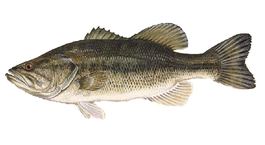
Largemouth Bass
Scientific Name:
Micropterus Salmoides
Learn more
|
|
|
 Common Name:
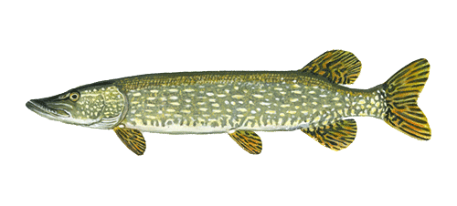
Northern Pike
Scientific Name:
Esox lucius
Learn more
|
This listing includes state-owned public boat access. There may be additional boat launches either public or private on this body of water.
More Information


